- Two Sided
- Foldable
- Waterproof
- Tear Resistant Synthetic Paper (Hop-Syn) 5 PP Tree Friendly
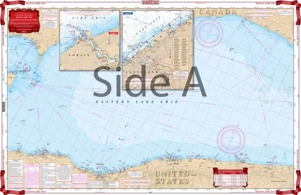
Coverage for Eastern Lake Erie with detailed insets for Cleveland and Lorain on one side. The reverse side details the East Basin with insets of the Welland Canal and the Niagara River. Information from NOAA Charts: #14810, #14820, #14822, #14824, & #14838. Chart is 25" X 38". WGS84 - World Mercator Datum.


